
Autel EVO Max 4T XE Industrial Drone Product Review
Autel EVO Max 4T XE Review | 4-in-1 Gimbal, All-Weather Fusion OA, Mesh Networking Industrial Flagship Review Introduction The Autel EVO Max 4T XE is Autel Robotics’ flagship industrial-grade multirotor drone built for professional missions including…
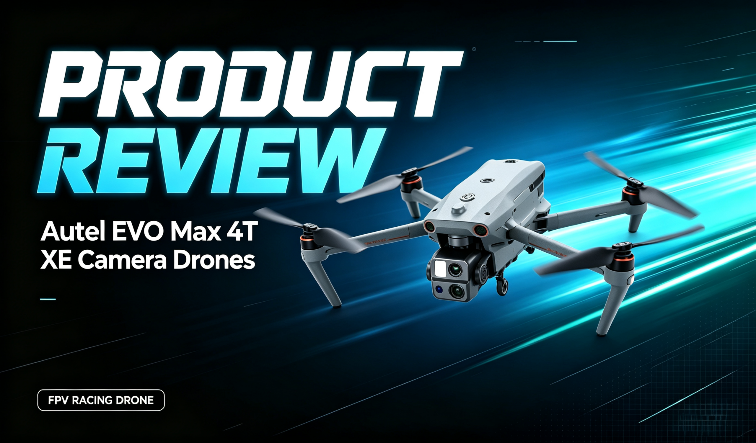
Autel EVO Max 4T XE Review | 4-in-1 Gimbal, All-Weather Fusion OA, Mesh Networking Industrial Flagship
Review Introduction
The Autel EVO Max 4T XE is Autel Robotics’ flagship industrial-grade multirotor drone built for professional missions including public safety, power inspection, emergency management and geographic surveying. At its core are the integrated 4-in-1 gimbal, 720° omnidirectional obstacle avoidance with dual fisheye vision + millimeter-wave radar, Autel Autonomy autonomous flight, industry-first A-Mesh ad-hoc networking, SLAM satellite-free navigation, 15km encrypted video link and 42-minute hot-swap endurance. With optional RTK centimeter positioning and mission payloads, it enables fully autonomous operation, multi-drone collaboration and all-weather perception in harsh, signal-degraded environments, setting a new benchmark for industrial drone performance. This hands-on review analyzes the integrated gimbal, obstacle perception, autonomous flight, networking capability, endurance & protection, and real-world pros & cons to evaluate its true operational capability for professional industrial and public safety procurement.
Hardware Breakdown
Rongguang 4T XE 4-in-1 Professional Gimbal System
A single integrated gimbal packs four sensing modalities, covering all mission scenarios in one payload with no swapping required:
- 10x continuous optical zoom camera: 1/2-inch CMOS, 48MP effective pixels, 10x optical zoom / up to 160x hybrid zoom, F2.8–F4.8 adjustable aperture; 8K stills and 4K@30fps video. Clearly identifies vehicle, vessel and equipment details from up to 2km away.
- Ultra-sensitive wide-angle camera: 1/2-inch CMOS, 48MP effective pixels, 83.4° FOV, 24mm equivalent focal length, up to ISO 32000 ultra-low-light performance. Delivers bright, clear wide-area imagery even in dim environments.
- Infrared thermal camera: 640×512 resolution, 9.1mm focal length, 16x digital zoom; dual temperature ranges: -20℃~150℃ (high gain) / 0℃~550℃ (low gain); accuracy ±2℃ or ±2% of reading; supports center-point, spot and area measurement with customizable high/low temperature alarms.
- Laser rangefinder: 5–1200m measurement range, accuracy ±(1m + 0.15% × distance). Outputs precise distance, altitude and geodetic coordinates of targets.
Review notes: The 4-in-1 integrated gimbal is one of the platform’s core strengths. A single payload delivers long-range detail, wide-area situational awareness, thermal anomaly detection and precision ranging — no in-flight payload swaps needed, drastically improving multi-mission efficiency. The zoom + wide + thermal + rangefinder combination is perfectly suited for power inspection, emergency rescue and law enforcement.
720° Omnidirectional Multi-Sensor Fusion Obstacle Avoidance
Dual-system architecture with dual fisheye vision + millimeter-wave radar delivers 720° full-environment perception covering front, rear, top, bottom, left and right:
- Vision perception: front/rear pinhole lenses + top/bottom fisheye lenses provide full spherical coverage, identify textured obstacles and work with onboard AI for path planning and dynamic collision avoidance.
- Millimeter-wave radar: 60GHz radars (front/rear/up directions) penetrate haze, smoke and low light to reliably detect glass, thin power lines, water surfaces and other obstacles that challenge vision-only systems. Downward radar assists precision landing and low-altitude detection.
- Intelligent avoidance modes: two selectable behaviors — Brake and Bypass — with customizable safety and warning distance thresholds. System autonomously plans optimal detour paths.
Review notes: Multi-sensor fusion OA is a generational improvement over vision-only systems. Vision handles texture; radar handles harsh weather and small targets. Together they enable true all-weather, all-scenario avoidance. Especially for power line inspection and smoke-filled fire scenes, millimeter-wave radar adds critical safety that vision alone cannot deliver.
Autonomous Flight & Multi-Mode Navigation
- Autel Autonomy autonomous flight: high-compute onboard chip and proprietary algorithm capture real-time 3D environmental data and automatically execute global path planning, 3D scene reconstruction, dynamic obstacle avoidance and smart RTH in complex terrain. Standardized inspection missions run without delicate manual control, reducing operator workload and improving mission consistency.
- SLAM visual navigation: for scenarios with blocked satellite signals, weak GNSS or strong electromagnetic interference, onboard SLAM outputs high-precision low-latency distance and coordinate data, enabling seamless indoor-outdoor navigation and stable hovering even without satellite connectivity.
- Positioning & link: 4-constellation GNSS (GPS/GLONASS/Galileo/BDS); SkyLink 3.0 multi-band adaptive frequency hopping, up to 15km (FCC) with AES-256 end-to-end encryption.
Review notes: Autonomous flight transforms the drone from a pilot-controlled tool into an automated work platform. Routine inspections run on planned waypoints with consistent results and much lower labor cost. SLAM solves the critical pain point of satellite outage in tunnels, urban canyons and high-EM environments. 15km encrypted link covers large-scale operations while meeting industrial and government data security requirements.
A-Mesh Ad-Hoc Networking
Industry-first A-Mesh technology enables device-to-device networking between drones and ground terminals without central infrastructure, building a local air-ground communication network:
- Multi-mode team operation: supports “one controller to multiple drones” and “master-slave dual control” collaboration modes. Multiple units share live feeds and real-time data for task division.
- Off-grid operation: works in remote areas with no cellular coverage — mountain valleys, tunnels, enclosed structures — ideal for emergency rescue and covert operations.
- Relay-extended range: drone-to-drone relay extends effective range and signal coverage far beyond single-aircraft limits.
Review notes: A-Mesh networking is a flagship capability that breaks the limits of single-drone operations. Multi-drone coordinated inspection, cross-obstacle relay and off-grid missions all become practical, greatly improving team efficiency and environmental adaptability.
Endurance, Airframe & Protection
- Endurance: up to 42 minutes in windless conditions; hot-swappable battery, 8-second swap without powering down.
- Airframe: foldable arms, folded size 257×145×131mm (excl. props); standard takeoff weight 1635g, max takeoff 1999g.
- Environment: customizable IP43 ingress protection; operating temperature -20℃~50℃; max service ceiling 4000m.
Review notes: 8-second hot-swap minimizes operational downtime for extended field missions. Compact when folded, easily carried by one operator for rapid deployment. Wide temperature range covers most climates; 4000m ceiling covers most plains and hills, with extreme high altitude being the limitation.
Flight Test Performance
Gimbal & Imaging Test
- Zoom camera: 10x optical zoom is smooth with minimal quality loss. Power tower components and equipment markers are clearly identifiable at 2km. 4K video is stable and detailed enough for inspection documentation.
- Wide-angle camera: excellent wide-area coverage in daylight with low distortion. Ultra-low-light mode brightens night scenes significantly while retaining shadow detail, delivering strong night situational awareness.
- Thermal imaging: smooth dual-range switching. Low gain for power equipment and fire detection; high gain for ambient and building thermometry. Accurate readings; penetrates smoke to locate heat sources and personnel.
- Laser rangefinder: fast response, accurate distance and coordinate output. Very useful for inspection marking, survey control points and geotagged evidence.
Obstacle Avoidance Test
- Daytime normal scenes: vision + radar fusion accurately detects buildings, trees and towers with smooth detour paths, greatly reducing pilot workload in complex sites.
- Night / smoke scenes: millimeter-wave radar dominates, maintaining reliable detection and avoidance where vision-only systems fail. True all-weather capability.
- Small target scenarios: detects thin power lines, greatly improving safety in corridor inspection. Two modes work well: Bypass for patrol cruise, Brake for precision station-keeping.
Autonomous Flight & Navigation Test
- Autonomous waypoint missions: drone flies the route, avoids obstacles and captures points automatically. Pilot only monitors state. Highly consistent repeatable missions.
- Weak satellite scenarios: SLAM takes over in valleys, urban canyons and high-EM environments. Hover is stable with minimal drift; smooth indoor-outdoor transition.
- Video link: approaches 15km in open areas. Frequency hopping performs well in industrial electromagnetic environments with low latency. Encrypted transmission meets security requirements.
Networking & Endurance Test
- A-Mesh networking: multi-drone teams form ad-hoc networks smoothly with synchronized video and data. Cross-obstacle relay effectively extends coverage. Works reliably off-grid.
- Endurance & hot-swap: real operational endurance 38–42 minutes, matching specs. 8-second battery swap with no reboot enables nearly uninterrupted continuous operation.
Key Strengths
✅ 4-in-1 integrated gimbal: zoom + wide + thermal + rangefinder in one payload, all-scenario coverage, high efficiency.
✅ 720° fusion all-direction OA: vision + radar dual system, all-weather all-scenario, detects thin wires, great safety in complex environments.
✅ Autonomous flight + SLAM navigation: automated waypoints, works without satellites, reduces pilot burden, consistent missions.
✅ A-Mesh ad-hoc networking: multi-drone collaboration, off-grid operation, relay range extension.
✅ 42min endurance + 8s hot-swap: long flight time + fast battery change for uninterrupted operation.
✅ 15km encrypted industrial link: long-range anti-interference, end-to-end encryption for data security.
✅ Foldable & wide temperature range: man-portable, -20℃~50℃ for most environments.
Identified Limitations
❌ Limited service ceiling: 4000m max altitude, not for extreme high-altitude plateau operations.
❌ IP43 is customizable: base protection is optional; higher ratings add cost.
❌ RTK is optional: centimeter-accuracy survey and fine inspection require separate purchase.
❌ Flagship price point: higher cost than entry-level and consumer drones.
❌ 640-class thermal: meets routine industrial inspection; insufficient for scientific-grade ultra-fine thermometry.
Suitable & Unsuitable Scenarios
👍 Best for:
- Power line, substation, solar and wind farm professional inspection.
- Law enforcement, large-area perimeter security, incident aerial overwatch.
- Emergency rescue, search & rescue, fire scene aerial reconnaissance.
- Geographic survey, engineering mapping, orthophoto collection.
- Multi-drone team operations, off-grid missions, cross-obstacle relay.
👎 Not recommended for:
- Extreme high-altitude operations above 4000m.
- Pure consumer recreational use on a tight budget.
- Scientific-grade ultra-fine thermometry and thermal analysis.
- Extended heavy rain or highly corrosive environments.
Side-by-Side Comparison
表格
| Item | Autel EVO Max 4T XE | DJI Mavic 3 Thermal (M4T) | GDU S400E |
|---|---|---|---|
| Positioning | Industrial flagship multi-mission platform | Lightweight flagship thermal inspection | Industrial flagship payload inspection |
| Gimbal | 4-in-1: zoom + wide + thermal + rangefinder | Dual: visible + thermal | Single thermal (interchangeable payloads) |
| Obstacle Avoidance | 720° vision + radar fusion | 6-way visual APAS 5.0 | Millimeter-wave + binocular full |
| Networking | A-Mesh multi-drone | None | BVLOS multi-UAV |
| Endurance | 42min + 8s hot-swap | 45min + hot-swap | 49min |
| Positioning | 4-constellation + SLAM + optional RTK | GPS + optional RTK | RTK ±0.1m hover |
| Payload | Integrated gimbal only | Reconnaissance only | Up to 3kg |
| Core Advantage | Multi-sensor all-scenario, strong OA, mesh | Portable, mature thermometry | Heavy payload, swarm capable |
| Best For | Multi-mission industrial flagship, public safety | Light professional inspection, rapid response | Industrial payload inspection, cluster ops |
Final Review Verdict
The Autel EVO Max 4T XE is a very capable industrial flagship multi-mission drone platform. Its 4-in-1 gimbal delivers all-scenario sensing in one payload, 720° multi-sensor fusion OA enables true all-weather operation, autonomous flight + SLAM reduces the human skill barrier, and A-Mesh networking breaks single-drone limits. Combined with long endurance hot-swap, long-range encrypted link and foldable portability, it delivers a very balanced package for power inspection, public safety, emergency rescue and surveying missions. Its limitations are clear: altitude limits, optional IP/RTK and flagship pricing. If you want lightweight portable thermal inspection, the Mavic 3T is more agile. If you need 3kg payload capacity, the S400E is better suited. This EVO Max 4T XE is the preferred choice in its class only when the mission demands multi-sensor all-scenario capability, strong obstacle avoidance, multi-drone networking and autonomous operation.
Product Page:https://iuavofficial.com/product/autel-evo-max-4t-xe-camera-drones/