G330 Thermal Imaging Industrial Drone Solution | 3-Axis Gimbal + 6-Direction OA + 40min Endurance, Covering Inspection / Security / Emergency / Monitoring Scenarios
Solution Overview This solution takes the G330 dual-sensor thermal imaging industrial drone as the core operational platform. Leveraging its 3-axis mechanical stabilized gimbal, visible + infrared thermal dual-camera system, 6-direction omnidirectional obstacle avoidance, 40-minute loaded endurance,…
Solution Overview
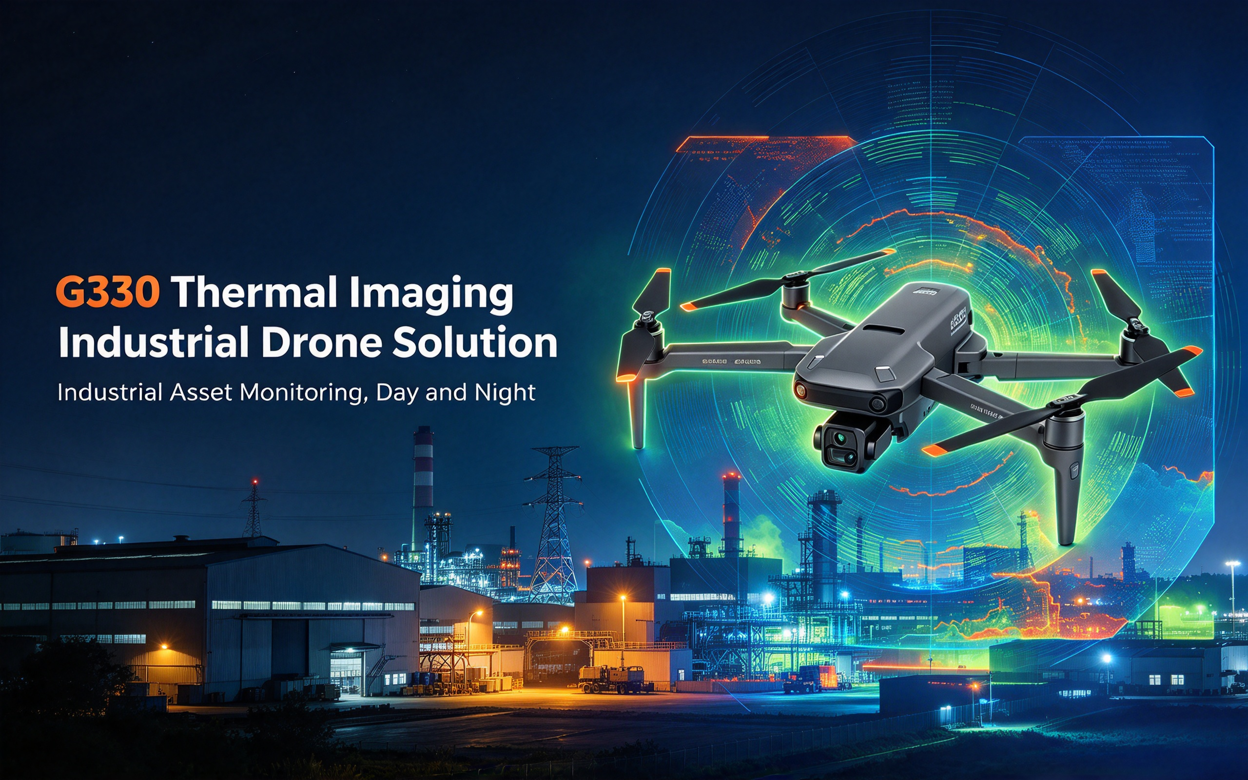
This solution takes the G330 dual-sensor thermal imaging industrial drone as the core operational platform. Leveraging its 3-axis mechanical stabilized gimbal, visible + infrared thermal dual-camera system, 6-direction omnidirectional obstacle avoidance, 40-minute loaded endurance, 6km long-range digital video link and foldable lightweight design, it provides highly integrated, highly reliable, cost-effective unmanned operation solutions for four core industrial scenarios: power & photovoltaic industrial inspection, campus & border security patrol, emergency rescue & search reconnaissance, and forest fire night monitoring. It addresses core industry pain points such as low efficiency and high risk of manual inspection, lack of OA and thermal imaging on small operational drones, and high cost and slow deployment of large industrial UAVs, achieving the optimal balance of efficiency, safety and cost in short-to-medium range industrial operation scenarios.
Four Common Pain Points in Industrial Operations
- Low efficiency and high risk of manual inspection: Manual inspection in power, photovoltaic and forest scenarios involves high labor intensity, high altitude risk and long cycles. It is heavily affected by weather and terrain with high missed-defect rates and delayed anomaly detection.
- Insufficient professionalism of small drones: Consumer-grade drones lack thermal temperature measurement capabilities and professional obstacle avoidance systems. They are prone to crashes in complex environments with poor image quality at night and in low light, failing to meet professional operational requirements.
- Excessive cost of large industrial UAVs: Professional industrial inspection UAVs have high procurement and maintenance costs, delivering very poor value for medium-sized stations and small-scale operations. They also feature large form factors, slow deployment and poor flexibility.
- Uneven day-night operation capability: Most devices perform well in daytime, but suffer from significantly degraded image quality and perception at night and in low light, making 24/7 continuous operation difficult.
Four Custom Scenario Solutions
Scenario 1: Power & Photovoltaic Industrial Inspection Solution
Applicable scenarios: High-voltage transmission line inspection, photovoltaic farm hot-spot detection, industrial equipment temperature measurement, substation routine inspection
Pain Points
- Power and photovoltaic facilities cover wide areas. Manual inspection involves high labor intensity, high altitude risk and long cycles, with delayed detection of defects and thermal anomalies.
- Ordinary drones lack thermal imaging capabilities and cannot identify equipment overheating. Without OA systems, they are prone to collisions in dense tower and cable areas.
- Professional inspection UAVs are expensive with complex deployment processes, delivering poor value for routine inspection at small and medium stations.
Solution Configuration
| Category | Configuration | Description |
|---|---|---|
| Operation Drone | G330 thermal imaging industrial drone (Inspection edition) | 3-axis stabilized gimbal, 4K visible + thermal dual camera, 6-direction omnidirectional OA, 40min endurance, 6km video link |
| Ground Terminal | Industrial ground receiving station, inspection data analysis terminal | Real-time dual-video return, temperature analysis, defect identification, data recording |
| Power Supply | 14.8V 5200mAh LiPo ×4 + balance charger | 40-minute loaded endurance per pack; multiple packs for all-day inspection |
| Auxiliary Equipment | Portable carrying bag, spare propellers, calibration tools | Convenient field transition; spares and calibration ensure operational accuracy |
Operation Process
- Inspection planning: Plan inspection routes, key detection points and flight parameters based on line and station distribution.
- Cruise inspection: Drone flies autonomously along planned routes. The 3-axis gimbal captures stable footage, collecting visible and thermal data simultaneously and transmitting back in real time.
- Defect marking: Automatically mark locations and temperature data when appearance damage or thermal anomalies are found, and record them for archiving.
- Report generation: Export data after inspection to generate professional inspection reports, sorting out defect levels and rectification suggestions.
Solution Value
- Simultaneous visible + thermal operation completes both visual inspection and temperature detection in one flight, improving inspection efficiency by 5–7 times compared with manual.
- 6-direction omnidirectional OA enables safe flight in dense tower and cable areas, greatly reducing crash risk with strong adaptability to complex station environments.
- 3-axis stabilized gimbal delivers stable HD footage at both high-speed cruise and fixed-point hover, with high detection accuracy.
- Procurement cost is much lower than professional industrial inspection drones, delivering excellent value for routine inspection at small and medium stations.
Scenario 2: Security & Border Patrol Solution
Applicable scenarios: Industrial park security patrol, border short-range inspection, factory aerial monitoring, key area security watch
Pain Points
- Manual ground patrol has many blind spots, high labor intensity and high safety risks, with difficulty patrolling at night and in complex terrain.
- Ordinary security drones have poor night image quality and no thermal imaging, making it difficult to identify hidden personnel and targets. Without OA systems, they are prone to collisions in buildings and wooded areas.
- Large security UAVs have high deployment costs and poor flexibility, with inconvenient scheduling for small-scale multi-point patrol.
Solution Configuration
| Category | Configuration | Description |
|---|---|---|
| Operation Drone | G330 thermal imaging industrial drone (Security edition) | 3-axis gimbal, dual-sensor imaging, 6-direction OA, 40min endurance, 6km long-range video link |
| Command Terminal | Security monitoring command terminal, video recording system | Real-time dual-video monitoring, anomaly warning, video recording, track playback |
| Power Supply | 14.8V 5200mAh LiPo ×5 + fast charger | Multiple packs for long-duration patrol operations |
| Auxiliary Equipment | Portable storage case, spare wear parts | Rapid transition; spares ensure continuous operation |
Operation Process
- Patrol planning: Plan patrol routes, key monitoring points and cruise parameters according to the security area.
- Autonomous patrol: Drone patrols autonomously along planned routes, transmitting real-time visible and thermal dual footage.
- Anomaly warning: Automatically trigger alerts when intrusion, temperature anomalies and other events are detected, with ground personnel verification and response.
- Recording & review: Automatically record patrol tracks and footage, supporting incident review and evidence collection.
Solution Value
- Dual-sensor imaging works day and night. Thermal imaging identifies hidden heat sources and personnel, greatly improving night patrol effectiveness and reducing monitoring blind spots.
- 6-direction OA adapts to complex building and forest environments for safe patrol with low collision risk.
- 40-minute long endurance covers large areas in a single sortie, improving patrol efficiency by 4–6 times compared with manual.
- Foldable and portable for rapid multi-point transition with flexible scheduling, at much lower cost than large security UAVs.
Scenario 3: Emergency Rescue & Search Reconnaissance Solution
Applicable scenarios: Fire scene aerial reconnaissance, mountain & water search and rescue, disaster site assessment, emergency rescue support
Pain Points
- Disaster and accident sites are complex and dangerous, making it difficult for personnel to quickly penetrate. On-site conditions are unclear, leaving command decisions without evidence.
- Ordinary drones have poor environmental adaptability, with signal dropout in smoke and complex terrain. Without thermal imaging, they struggle to quickly locate trapped people and fire sources.
- Large emergency UAVs deploy slowly and are expensive, difficult for grassroots teams to equip with slow response.
Solution Configuration
| Category | Configuration | Description |
|---|---|---|
| Operation Drone | G330 thermal imaging industrial drone (Emergency edition) | 3-axis gimbal, dual-sensor imaging, 6-direction OA, 40min endurance, 6km anti-interference video link |
| Command Terminal | Portable command terminal, HD display | Frontline command views live dual footage in real time to coordinate rescue forces |
| Power Supply | 14.8V 5200mAh LiPo ×4 + fast charger | Quick battery swaps for continuous reconnaissance operations |
| Auxiliary Equipment | Portable protective case, spare wear parts, lighting module | Rapid deployment, night operation assistance |
Operation Process
- Rapid deployment: Quickly unfold the drone on arrival and launch to rapidly reach the target area.
- On-site reconnaissance: Capture visible and thermal footage from the air, transmit back to command in real time, and quickly locate trapped people, fire sources and hazards.
- Command & dispatch: Commanders coordinate rescue forces and formulate response plans based on live footage.
- Continuous support: Rotate batteries for sustained operations, monitoring on-site situation changes to support ground rescue efforts.
Solution Value
- Foldable and portable for rapid deployment, operational immediately on arrival with much faster emergency response than large UAVs.
- Dual-sensor thermal imaging quickly identifies heat sources and trapped people, operating normally in smoke and night environments, greatly improving search and rescue efficiency.
- 6-direction OA adapts to complex disaster sites for safe operation with low accident risk.
- Affordable and easy to operate, deployable by grassroots emergency, fire and rescue teams to quickly improve emergency response capability.
Scenario 4: Forest Fire & Night Monitoring Solution
Applicable scenarios: Forest fire patrol, forest fire spot monitoring, illegal activity night surveillance, night operation reconnaissance
Pain Points
- Manual forest patrol is inefficient with limited coverage. Hidden fires and small hot spots are difficult to detect at night, leading to late detection and large losses.
- Ordinary drones have poor night image quality. Without thermal imaging, they struggle to identify hidden fires and high-temperature points with high missed-detection rates.
- Large fire-fighting UAVs are expensive with low cost-effectiveness for daily patrol, difficult to popularize in grassroots forest areas.
Solution Configuration
| Category | Configuration | Description |
|---|---|---|
| Operation Drone | G330 thermal imaging industrial drone (Fire edition) | 3-axis gimbal, dual-sensor imaging, 6-direction OA, 40min endurance, long-range video link |
| Monitoring Terminal | Fire monitoring terminal, fire spot identification system | Real-time thermal footage, automatic fire spot identification & positioning, temperature monitoring |
| Power Supply | 14.8V 5200mAh LiPo ×5 + balance charger | Multiple packs for long-duration patrol operations |
| Auxiliary Equipment | Portable storage case, spare wear parts | Convenient field transition; spares ensure continuous operation |
Operation Process
- Patrol planning: Plan patrol routes, key monitoring areas and flight parameters according to forest area.
- Autonomous patrol: Drone patrols autonomously along planned routes. Thermal imaging monitors area temperatures in real time, with visible light for confirmation.
- Fire spot warning: Automatically locate and warn of abnormal hot spots and fires, with ground personnel verification and response.
- Fire monitoring: During fires, continuously monitor fire development from the air to support firefighting operations.
Solution Value
- Thermal imaging accurately identifies hot spots and hidden fires, enabling early detection with less damage, improving patrol efficiency several times over manual.
- 40-minute long endurance covers large forest areas in a single sortie with low daily patrol cost.
- 6-direction OA adapts to complex mountain forest environments for safe operation with low accident risk.
- Low cost and easy to deploy, equipable by grassroots forest and fire prevention units to quickly improve forest fire prevention capabilities.
5-Step Solution Implementation Process
- Demand research and solution customization: Investigate operation scenarios, core demands and environmental conditions, and customize corresponding payloads, configurations and operation processes.
- Equipment deployment and training: Deliver and commission equipment, conduct operation training, safety training and scenario-based practical training.
- Trial operation and parameter optimization: Conduct on-site trial operation, and adjust FC parameters, VTX power and route logic based on actual performance.
- Formal operation and process standardization: Launch formal operations, and standardize operating procedures, management specifications and emergency plans.
- Operation & maintenance support and iterative optimization: Provide regular maintenance and spare parts support, and iteratively optimize solution configurations according to business development.
Core Solution Values
✅ Professional dual-sensor imaging: 4K visible + thermal dual camera with 3-axis stabilized gimbal, operable day and night with stable, high-precision imagery.
✅ Omnidirectional safety OA: 6-direction omnidirectional obstacle avoidance system for safe flight in complex environments, greatly reducing crash risk.
✅ Long-endurance high efficiency: 40-minute loaded endurance and 6km long-range video link deliver large single-mission coverage and high efficiency.
✅ Wide scenario coverage: Covers four industrial scenarios: inspection, security, emergency and monitoring, all in one drone with strong adaptability.
✅ Portable rapid deployment: Foldable lightweight design, 960g total weight, single-person carry and transition, rapid operational deployment.
✅ Significant cost advantage: Procurement and maintenance costs are much lower than large industrial UAVs, delivering the best return for medium-scale operations.
Tiered Configuration Procurement Advice
- Entry inspection edition: Standard drone + ground receiving terminal + 3 batteries, suitable for entry-level industrial inspection and daily operation practice.
- Security patrol edition: Standard drone + security monitoring terminal + 5 batteries, suitable for campus and border security patrol operations.
- Emergency rescue edition: Standard drone + portable command terminal + 4 batteries + emergency accessories, suitable for emergency rescue and fire reconnaissance operations.
- Team operation edition: Multiple drones + command system + bulk spares + charging support, suitable for organizational scaled operations.