
8-Inch QUAD X4 FPV Payload Drone Industry Solution | 2.5kg Payload & Long Endurance, Covering Inspection / Aerial Photography / SAR / Surveying Scenarios
Solution Overview This solution takes the 8-inch QUAD X4 FPV payload drone as the core operational platform. Leveraging its 8-inch large-wheelbase airframe with 2.5kg maximum payload, 12–15 minute endurance under load, multi-band high-power long-range video link,…
Solution Overview
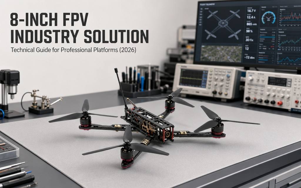
This solution takes the 8-inch QUAD X4 FPV payload drone as the core operational platform. Leveraging its 8-inch large-wheelbase airframe with 2.5kg maximum payload, 12–15 minute endurance under load, multi-band high-power long-range video link, ELRS 915M/2.4G long-range receiver system and 0.01Lux ultra-low-light starlight imaging system, it provides high-mobility, cost-effective unmanned operation solutions for four core medium-load scenarios: medium-load industrial inspection, professional aerial photography, emergency search & rescue reconnaissance, and small-to-medium scale surveying & exploration. It addresses core pain points such as insufficient payload of small drones, excessive cost of large industrial UAVs and low efficiency of medium-duty tasks, achieving the optimal balance of efficiency, cost and maneuverability for medium-load operational scenarios.
Four Common Pain Points in Medium-Load Operations
- Insufficient payload of small drones: 5–7 inch FPV drones generally have a payload under 2kg, unable to carry medium inspection equipment, professional cameras and other work tools. They can only complete light tasks and fall short in medium-load scenarios.
- Dual shortage of endurance and signal at medium range: Endurance drops significantly under load, resulting in short effective operation time. Common video links have poor anti-interference performance, with signal dropout at medium range and in obstructed environments, limiting operating radius.
- Difficulty mounting professional equipment: Professional work equipment is larger and heavier. Mounted on small drones, it causes center-of-gravity offset, poor flight stability and severe camera shake, failing to meet operational accuracy requirements.
- Unbalanced operation cost: Professional industrial UAVs have high procurement and maintenance costs, making them very cost-ineffective for medium-scale missions. Manual operations are inefficient, high-risk and difficult to carry out in complex environments.
- Limited low-light operation: Standard cameras produce poor image quality at night and in low light. Operations cannot be carried out normally at dusk, on overcast days or indoors, limiting working hours.
Four Custom Scenario Solutions
Scenario 1: Medium-Load Industrial Inspection Solution
Applicable scenarios: Detailed power equipment inspection, oil & gas station inspection, factory heavy equipment inspection, infrastructure special inspection
Pain Points
- 5–7 inch small drones have insufficient payload to carry medium thermal imagers and HD inspection equipment, failing to deliver required detail and accuracy.
- Professional inspection UAVs are expensive and deliver poor value for medium-scale station inspection tasks.
- Complex equipment and pipeline layouts with many obstructions cause common drones to lose video signal, breaking inspection continuity.
Solution Configuration
| Category | Configuration | Description |
|---|---|---|
| Operation Drone | 8-inch QUAD X4 FPV drone (Inspection edition) | F405 V3 FC, 2812 motor KV1100, 50A AM32 ESC, 1700TVL starlight camera, multi-band high-power VTX, ELRS 915M long-range receiver |
| Inspection Payload | Medium thermal module, HD visible gimbal, gas detection sensor | 2.5kg max payload carries various medium inspection devices for detailed inspection |
| Ground Terminal | Industrial ground receiving station, inspection data analysis terminal | Real-time video return, defect identification, data recording and analysis |
| Power Supply | 6S 800mAh LiPo ×6 + balance charger | 12–15 minutes loaded endurance per pack; multiple packs for all-day inspection |
| Auxiliary Equipment | Industrial protective case, spare propellers, calibration tools | Outdoor transition protection, equipment calibration, spares for continuous operation |
Operation Process
- Inspection planning: Plan inspection routes, key detection points and flight altitude based on station / pipeline distribution.
- Autonomous cruise: Drone flies along the planned route, transmitting real-time visible and thermal footage; pilot monitors flight status and signal quality.
- Defect detection: Mark locations, record footage and log data when abnormal heating, damage or leakage are found.
- Report generation: Export data after inspection, generate inspection reports, and sort out defect levels and rectification suggestions.
Solution Value
- 2.5kg payload meets medium inspection equipment requirements, with far higher inspection precision and professionalism than small drones.
- Procurement cost is only 1/3–1/5 of professional industrial inspection drones, delivering excellent value for medium-scale station inspection.
- ELRS long-range receiver + multi-band high-power VTX deliver stable signal in obstructed and complex electromagnetic environments for uninterrupted inspection.
- 0.01Lux starlight camera enables inspection at night and in low light, extending effective operating hours.
Scenario 2: Professional Aerial Photography Solution
Applicable scenarios: Professional film & television aerial photography, commercial event tracking, natural landscape creation, construction progress documentation
Pain Points
- Small FPV drones have insufficient payload to carry professional cameras and stabilized gimbals, failing to meet professional creative standards for image quality and stability.
- Professional cinema drones are expensive and lack maneuverability, unable to execute creative FPV shots such as fly-throughs and low-altitude tracking.
- Medium-to-long range shots are limited by insufficient video range and signal dropout, restricting creative scope and shot design.
Solution Configuration
| Category | Configuration | Description |
|---|---|---|
| Operation Drone | 8-inch QUAD X4 FPV drone (Aerial photography edition) | F405 V3 FC, 2812 motor KV1100, 50A AM32 ESC, 1700TVL starlight camera, high-power VTX, ELRS long-range receiver |
| Mount Payload | Mirrorless camera, 3-axis stabilized gimbal, professional audio equipment | 2.5kg max payload carries professional imaging equipment; CG-optimized design ensures flight stability |
| Monitoring Terminal | HD video monitor, follow-shot assistant display | Monitor footage in real time for precise camera movement control |
| Control | Multi-channel ELRS professional transmitter | Precise fine-tuning for professional tracking and complex camera movements |
| Power Supply | 6S 800mAh LiPo ×5 + portable fast charger | Covers single-day shooting; convenient outdoor fast charging |
Operation Process
- Creative storyboarding: Plan flight routes, camera movements, shooting points and camera techniques according to production requirements.
- Test flight tuning: Test fly on site to adjust FC parameters, VTX frequency and power, and confirm image quality and handling feel.
- Principal photography: Execute flight shots according to storyboard, completing fly-throughs, tracking shots and wide orbits.
- Footage organization: Export media after shooting, organize and back up files.
Solution Value
- Balances FPV high maneuverability and professional payload capacity. Carries mirrorless camera + gimbal for professional production-grade image quality.
- Costs significantly less than professional cinema drones, while achieving creative shots impossible for traditional aerial platforms, such as fly-throughs and low-altitude tracking.
- High-power long-range VTX supports medium-to-long range long takes for greater creative freedom and wider scenario adaptability.
- Starlight low-light imaging suits atmospheric shooting at dawn/dusk and on overcast days for more flexible production schedules.
Scenario 3: Emergency SAR & On-Site Reconnaissance Solution
Applicable scenarios: Fire scene reconnaissance, mountain & water search and rescue, disaster site assessment, emergency incident aerial monitoring
Pain Points
- Disaster and accident sites have complex environments with heavy smoke and building obstruction. Common drones lose signal and produce blurry footage with poor reconnaissance results.
- Small drones have insufficient payload to carry thermal imagers, loudspeakers, delivery devices and other SAR equipment, with limited functionality.
- Large emergency drones are slow to deploy and expensive, difficult for grassroots teams to equip with slow response.
Solution Configuration
| Category | Configuration | Description |
|---|---|---|
| Operation Drone | 8-inch QUAD X4 FPV drone (SAR edition) | F405 V3 FC, 2812 motor, 50A ESC, 1700TVL starlight camera, high-power multi-band VTX, ELRS 915M receiver |
| Mission Payload | Medium thermal imager, long-range loudspeaker, emergency delivery device | 2.5kg payload carries multiple SAR devices simultaneously, multi-functional |
| Command Terminal | Portable ground command station, HD display | Frontline command views live site footage in real time to coordinate rescue forces |
| Power Supply | 6S 800mAh LiPo ×4 + fast charger | Quick battery swaps for continuous reconnaissance and rescue |
| Auxiliary Equipment | Portable protective case, spare wear parts, lighting module | Rapid deployment, night operation assistance |
Operation Process
- Rapid deployment: Quickly assemble and take off after arriving on scene, rapidly reach target area for aerial reconnaissance.
- Situation transmission: Transmit real-time visible/thermal footage and location information to support command decision-making.
- Target search: Search for trapped people, fire origins and hazards per instructions, mark locations and on-site conditions.
- Continuous monitoring: Rotate batteries for sustained operation to monitor on-site situation changes and support ground rescue operations.
Solution Value
- Moderate size and rapid deployment, takeoff within minutes for operations, much faster response than large emergency drones.
- 2.5kg payload carries thermal, loudspeaker, delivery and other payloads, combining reconnaissance and rescue assistance with full functionality.
- ELRS 915M long-range receiver + high-power VTX deliver stable signal in smoke, obstructed and complex electromagnetic environments with long reconnaissance range.
- Low cost and easy operation, deployable by grassroots emergency, fire and rescue teams to quickly improve response capability.
Scenario 4: Small-to-Medium Scale Surveying & Exploration Solution
Applicable scenarios: Small-to-medium area topographic mapping, mine engineering survey, construction progress monitoring, land resource investigation
Pain Points
- Small drones have insufficient payload to carry survey-grade cameras and positioning equipment, failing to meet professional mapping accuracy standards.
- Professional surveying UAVs are expensive and process-heavy, delivering very poor value for small-to-medium survey tasks.
- Complex terrain and obstructed areas cause poor signal for common drones, limiting operating range and resulting in incomplete survey coverage.
Solution Configuration
| Category | Configuration | Description |
|---|---|---|
| Operation Drone | 8-inch QUAD X4 FPV drone (Survey edition) | F405 V3 FC, 2812 motor, 50A ESC, 1700TVL starlight camera, high-power VTX, ELRS long-range receiver |
| Survey Payload | Survey-grade orthophoto camera, high-precision positioning module | 2.5kg payload carries medium survey equipment, meeting accuracy requirements for small-to-medium survey areas |
| Data Terminal | Ground receiving station, survey data processing terminal | Real-time image data return and pre-processing |
| Power Supply | 6S 800mAh LiPo ×5 + balance charger | Ensure continuous field operation time |
| Auxiliary Equipment | Survey marking tools, portable protective case | Convenient field operations with proper equipment protection |
Operation Process
- Survey area planning: Plan flight routes, overlap, altitude and camera parameters according to survey scope and accuracy requirements.
- Aerial acquisition: Drone flies along planned routes, collecting images and positioning data simultaneously; monitor signal and flight status in real time.
- Quality check: Check data integrity and overlap after each sortie, re-shoot missing and substandard areas.
- Office processing: Import data for stitching and correction to generate orthophotos, topographic maps and other survey deliverables.
Solution Value
- 5–10 times more efficient than manual surveying for small-to-medium areas, much lower cost than professional survey drones with outstanding cost performance.
- 2.5kg payload carries survey-grade camera and positioning module, with mapping accuracy meeting specifications for small-to-medium engineering and exploration projects.
- Stable long-range signal enables operation in complex terrain and obstructed areas with complete survey coverage and fast redeployment.
- Simple operation and maintenance, usable by ordinary engineering teams without professional survey crews.
5-Step Solution Implementation Process
- Demand research and solution customization: Investigate operation scenarios, core demands and environmental conditions, and customize corresponding payloads, configurations and operation processes.
- Equipment deployment and training: Deliver and commission equipment, conduct operation training, safety training and scenario-based practical training.
- Trial operation and parameter optimization: Conduct on-site trial operation, and adjust FC parameters, VTX power and route logic based on actual performance.
- Formal operation and process standardization: Launch formal operations, and standardize operating procedures, management specifications and emergency plans.
- Operation & maintenance support and iterative optimization: Provide regular maintenance and spare parts support, and iteratively optimize solution configurations according to business development.
Core Solution Values
✅ Moderate payload capacity: 2.5kg maximum payload covers most medium-load operational needs, balancing payload and maneuverability.
✅ Excellent endurance performance: 12–15 minutes endurance under load, far higher than similar small drones, with long effective operation time.
✅ Stable long-range signal: ELRS long-range receiver + multi-band high-power VTX with strong anti-interference for stable medium-range and obstructed-environment operation.
✅ Wide scenario coverage: Covers four medium-load scenarios: inspection, aerial photography, SAR and surveying, all in one drone with strong adaptability.
✅ Outstanding cost performance: Procurement and maintenance costs are much lower than professional industrial UAVs, delivering the best return for medium-scale missions.
✅ Strong low-light adaptability: 0.01Lux starlight ultra-low-light imaging enables normal operation at night and in low-light environments.
Tiered Configuration Procurement Advice
- Entry operation edition: Base configuration + 2.4G ELRS + standard VTX + 3 batteries, suitable for entry-level medium-load operation and advanced flight practice.
- Professional inspection edition: Standard configuration + 915M ELRS + high-power VTX + 5 batteries + medium inspection payload, suitable for industrial inspection and equipment detection.
- Professional aerial edition: Tuned configuration + 915M long-range receiver + HD VTX + 5 batteries + imaging payload, suitable for professional aerial photography and video production.
- Team operation edition: Multiple operation drones + ground command system + bulk spares + charging system, suitable for organizational scaled operations.
Product Page: https://iuavofficial.com/product/8-inch-quad-x4-fpv-drone/