
B30 Heavy-Lift Hexacopter Industrial Application Solution | 30kg Payload & 6-Axis Redundancy, Covering Delivery / Logistics / Inspection / Surveying Scenarios
Solution Overview This solution takes the B30 heavy-lift hexacopter as the core operational platform. Leveraging its 30kg standard payload, 6-axis redundant powertrain, 58-minute long endurance, 30km long-range video link, LIDAR obstacle avoidance, RTK high-precision positioning and…
Solution Overview
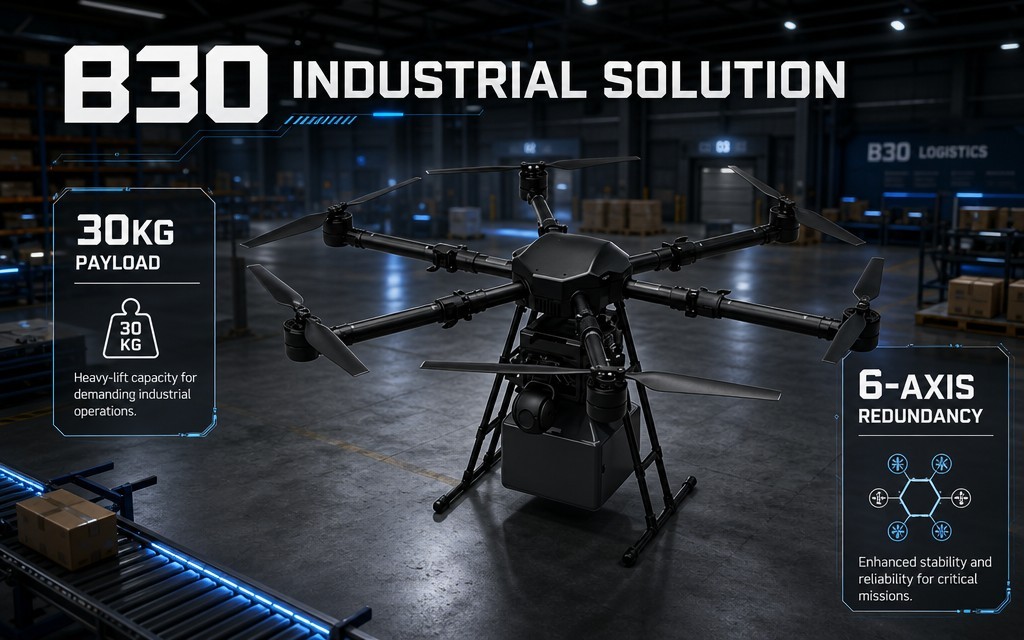
This solution takes the B30 heavy-lift hexacopter as the core operational platform. Leveraging its 30kg standard payload, 6-axis redundant powertrain, 58-minute long endurance, 30km long-range video link, LIDAR obstacle avoidance, RTK high-precision positioning and IP54 industrial-grade protection, it provides standardized and customizable unmanned operation solutions for four core industrial scenarios: precision emergency relief delivery, industrial site logistics transfer, power corridor inspection, and large-area topographic surveying. It addresses core pain points of traditional operation modes such as low efficiency, high risk, high cost and terrain constraints, and comprehensively improves the safety, efficiency and economy of industrial operations.
Four Common Pain Points in Industrial Operations
- Difficult emergency delivery: Disasters often cause road disruptions and complex terrain. Manual delivery involves high risk, slow speed and poor accuracy, making it hard to deliver supplies to target areas quickly and precisely.
- Slow industrial logistics: In mountain factories, construction sites and field camps with poor or no road access, material transfer relies heavily on manual labor with high cost, low efficiency and frequent safety accidents.
- Risky corridor inspection: Long-distance power and oil & gas corridors traverse complex terrain. Manual inspection features heavy workload, high risk, long cycles and high missed-defect rates.
- Low surveying efficiency: Large-area topographic survey and engineering survey are limited by terrain. Manual surveying takes long cycles, costs much, and cannot reach complex dangerous areas, with uneven result accuracy.
Four Custom Scenario Solutions
Scenario 1: Precision Emergency Relief Delivery Solution
Applicable scenarios: Emergency supply delivery in disasters such as earthquakes, floods and wildfires; delivery of rescue equipment and supplies in remote areas; precise material distribution for isolated or trapped personnel.
Pain Points
- Disaster-induced road disruptions completely block ground transport, making it impossible to deliver supplies in time.
- Manual delivery exposes rescue personnel to high safety risks, with low delivery accuracy and small coverage.
- Traditional small drones have insufficient payload capacity, only capable of delivering light supplies and unable to meet batch supply demands.
Solution Configuration
表格
| Category | Configuration | Description |
|---|---|---|
| Operation Drone | B30 heavy-lift hexacopter (dual-delivery version) | 30kg payload capacity, supports dual-path delivery for multi-category supplies |
| Delivery System | Professional dual-compartment delivery mechanism | 25kg max per single path, supports dual-batch and multi-point precise delivery |
| Command Terminal | Industrial ground command station | Route planning, real-time monitoring, delivery control, multi-drone scheduling |
| Power Supply | Dual standard battery packs + 2 spare packs + smart fast charger | Guarantee continuous operation with quick rotation and recharging |
| Auxiliary Equipment | Emergency lighting and loudspeaker module | For night operation and on-site command communication |
Operation Process
- Disaster assessment: Combine on-site information to clarify delivery points, material types and weights, and plan safe delivery altitudes.
- Route planning: The ground station plans delivery routes, avoids obstacles and dangerous areas, and sets delivery point parameters.
- Precision delivery: The drone flies autonomously to the target area and releases supplies in single or dual mode per command, with meter-level accuracy.
- Effect review: Capture post-delivery on-site footage, transmit back to the command center, evaluate delivery effect and plan the next batch.
Solution Value
- Breaks through terrain constraints. First-round material delivery can be completed within 45 minutes in road-disrupted scenarios, improving response speed by 80%.
- 30kg-class payload enables batch delivery of food, medicine and equipment, meeting the supply needs of 10–20 people per sortie.
- 6-axis power redundancy + LIDAR obstacle avoidance ensure high operational safety in complex terrain and bad weather, keeping rescue personnel out of danger.
- Dual-delivery design enables multi-point delivery, improving operation efficiency by 50% compared with single delivery.
Scenario 2: Industrial Site / Construction Heavy-Lift Logistics Transfer Solution
Applicable scenarios: Material transfer at mountain factories, construction sites, field camps and island stations; point-to-point air transport of heavy tools, components and building materials.
Pain Points
- In mountain and remote areas with no or poor roads, ground transport is slow and costly, making it difficult to transfer large and heavy materials.
- Manual handling has high labor intensity and frequent safety accidents; small transfer equipment has insufficient payload for heavy materials.
- Traditional transportation is heavily affected by weather and terrain, unable to guarantee stable operation rhythm.
Solution Configuration
| Category | Configuration | Description |
|---|---|---|
| Operation Drone | B30 heavy-lift hexacopter (custom mount version) | 30kg standard payload, compatible with various custom mounting fixtures |
| Mount System | Custom cargo mount / sling | Adapt to boxed, bagged and irregular materials; secure mounting ensures flight safety |
| Dispatch Terminal | Factory dispatch command system | Multi-point demand docking, intelligent route planning, operation scheduling management |
| Power Supply | Multiple spare battery packs + ground fast-charging stations | Quick battery swap at fixed points for continuous transfer operations |
| Safety Package | LIDAR obstacle avoidance + redundant powertrain | Flight safety in complex factory environments; forced landing capability with single motor failure |
Operation Process
- Demand submission: Each work station submits transfer requests via the system, specifying material, weight, origin and destination.
- Dispatch planning: The dispatch system plans optimal routes intelligently, assigns drone tasks and avoids buildings, cables and other obstacles.
- Point-to-point transfer: The drone flies autonomously after loading, lands precisely at the target point, and returns automatically after unloading.
- Record management: The system automatically records transfer tasks, weights and durations, generating operation logs and cost accounting.
Solution Value
- Free from terrain and road constraints, point-to-point direct transport improves efficiency by 2–3 times and reduces comprehensive cost by 40% compared with ground transport.
- 30kg payload covers the transfer needs of most industrial materials, tools and components, with wide scenario adaptability.
- 6-axis redundant power + IP54 protection enable operation in level-7 wind and short light rain, ensuring all-weather production rhythm.
- Unmanned transfer reduces safety accidents in high-altitude and mountain handling, greatly lowering personnel operational risks.
Scenario 3: Long-Distance Power / Oil & Gas Corridor Inspection Solution
Applicable scenarios: Routine inspection, defect detection and hidden hazard monitoring of high-voltage transmission lines, long-distance oil & gas pipelines and railway corridors.
Pain Points
- Corridors traverse mountains, forests and canyons. Manual inspection is difficult, slow and extremely inefficient.
- Manual inspection in high-altitude and high-voltage environments carries high risk, is weather-sensitive, and suffers from high missed-defect rates and delayed hazard detection.
- Traditional small drones have short endurance and low payload, requiring multiple takeoffs for long corridors and resulting in fragmented operations.
Solution Configuration
| Category | Configuration | Description |
|---|---|---|
| Operation Drone | B30 heavy-lift hexacopter (inspection version) | 58-minute hover endurance, 30km long-range video link for long-distance operations |
| Inspection Payload | Visible-light + thermal dual-sensor gimbal, laser rangefinder | Simultaneous appearance defect detection, thermal anomaly detection and distance measurement |
| OA & Positioning | 4-direction LIDAR obstacle avoidance + RTK centimeter-level positioning | Autonomous obstacle avoidance in complex terrain; highly repeatable routes |
| Ground Terminal | Long-range video ground station + inspection management system | Real-time video return, defect identification, inspection report generation |
| Power Supply | Dual standard battery packs + 1 spare pack | Long single-sortie operation; multi-battery rotation for all-day inspection |
Operation Process
- Route planning: Plan autonomous inspection routes based on corridor coordinates, set photo points and temperature measurement points, and input tower / valve reference data.
- Autonomous inspection: The drone flies along the planned route, automatically avoids obstacles via LIDAR, and simultaneously captures visible and thermal data.
- Defect identification: Data is transmitted to the ground station in real time, with AI-assisted identification of insulator damage, abnormal heating, pipeline leakage and other defects.
- Report generation: Automatically generate inspection reports, mark defect locations and severity, and form inspection logs and rectification suggestions.
Solution Value
- Single-sortie endurance covers tens of kilometers of corridor inspection, improving efficiency by more than 10 times and greatly shortening inspection cycles compared with manual inspection.
- Dual-sensor payload completes appearance and temperature detection simultaneously, improving defect identification rate and greatly reducing missed defects.
- Unmanned operation eliminates personnel exposure to high-altitude, high-voltage and field risks, fundamentally improving inspection safety.
- RTK positioning ensures highly repeatable routes for periodic inspection, facilitating trend comparison and hazard tracing.
Scenario 4: Large-Area Topographic Surveying & Exploration Solution
Applicable scenarios: Topographic mapping, engineering survey, land investigation, mine surveying, construction progress monitoring.
Pain Points
- Large-area manual surveying has long cycles and high manpower input. Complex mountainous and dangerous areas are inaccessible, leaving mapping gaps.
- Traditional small lightweight drones have limited payload, lower-precision survey sensors and short endurance, requiring multiple sorties for large areas with large stitching errors.
- Poor positioning accuracy in complex environments makes it difficult to meet professional surveying standards for mapping accuracy.
Solution Configuration
| Category | Configuration | Description |
|---|---|---|
| Operation Drone | B30 heavy-lift hexacopter (survey version) | Sufficient payload margin for professional survey equipment; stable flight platform |
| Survey Payload | Orthophoto camera / oblique photography module | High-resolution image acquisition meeting survey mapping accuracy requirements |
| Positioning System | RTK centimeter-level positioning + ground reference station | Centimeter-level absolute positioning accuracy ensuring mapping precision |
| Data Terminal | Ground station + survey data processing software | Integrated route planning, data export and office mapping |
| Power Supply | Rotating multiple battery packs | Ensure continuous field operation and reduce transition waiting time |
Operation Process
- Flight strip planning: Plan flight routes, overlap and altitude according to survey area scope and accuracy requirements.
- Autonomous flight: The drone flies along the planned route, exposes precisely with RTK positioning, and captures images and positioning data simultaneously.
- Data acquisition: Complete large-area image capture in a single sortie, with automatic data storage and breakpoint endurance support.
- Office processing: Import data into processing software to generate orthophotos, 3D models and other survey deliverables with compliant accuracy.
Solution Value
- Large-area aerial survey efficiency is dozens of times higher than manual surveying, shortening mapping cycles from months to days.
- 30kg payload supports higher-precision survey equipment; combined with RTK centimeter positioning, mapping accuracy meets professional survey standards.
- Data collection is completed without personnel entering complex and dangerous terrain, ensuring field personnel safety.
- LIDAR obstacle avoidance + stable flight platform ensure safe flight and consistent data acquisition in mountainous and complex terrain.
5-Step Solution Implementation Process
- Demand research and solution customization: Investigate operation scenarios, core demands and environmental conditions, and customize corresponding payloads, configurations and operation processes.
- Equipment deployment and personnel training: Deliver and commission equipment, conduct operation training, safety training and scenario-based practical training.
- Trial operation and parameter tuning: Conduct on-site trial operation, and adjust flight control parameters, route logic and obstacle avoidance thresholds based on actual performance.
- Formal operation and process standardization: Launch formal operations, and standardize operating procedures, management specifications and emergency plans.
- Operation & maintenance support and iterative optimization: Provide regular maintenance and spare parts support, and iteratively optimize solution configurations according to business development.
Core Solution Values
✅ Safe and reliable: 6-axis power redundancy, LIDAR obstacle avoidance and IP54 protection provide multiple guarantees to improve operational safety in complex environments and reduce personnel risks.
✅ Cost reduction and efficiency improvement: Unmanned operations replace manual labor, with several times higher efficiency and significantly lower comprehensive operating costs, delivering a short payback period.
✅ Environmental adaptability: Wide temperature range, Level 7 wind resistance and IP54 protection adapt to various complex conditions such as mountains, fields and bad weather.
✅ Precision operation: RTK centimeter-level positioning and professional payload configurations deliver professional-grade accuracy for delivery, inspection and surveying.
✅ Flexible and scalable: Supports payload customization, multi-drone scheduling and system integration, with flexible capacity expansion according to business development.
Tiered Configuration Procurement Advice
- Entry-level (single-scenario basic operation): B30 base unit + single-scenario payload + basic ground station + 2 battery packs, meeting single operation demands.
- Standard-level (multi-scenario routine operation): B30 standard unit + 2–3 interchangeable payloads + professional ground station + 3 battery packs + spare parts kit, adapting to routine multi-scenario operations.
- Professional-level (large-scale project operation): B30 fleet + full-scenario payloads + command & dispatch system + RTK base station + operation & maintenance system, meeting large-scale professional project demands.