
Lion7 7-Inch Carbon Fiber FPV Long-Range Drone Solution | 20km Range + 7km Ceiling + 45min Endurance, Covering Exploration / Surveying / Logistics / High-Altitude Scenarios
Solution Overview This solution is built around the Lion7 7-inch carbon fiber long-range FPV drone as the core operational platform. Leveraging its high-strength carbon fiber airframe, 20km ultra-long-range control link, 7km maximum flight altitude, 3.5kg maximum…
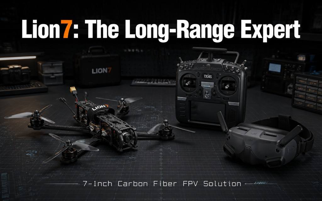
Solution Overview
This solution is built around the Lion7 7-inch carbon fiber long-range FPV drone as the core operational platform. Leveraging its high-strength carbon fiber airframe, 20km ultra-long-range control link, 7km maximum flight altitude, 3.5kg maximum payload, 45-minute extended endurance, 150km/h high-speed powertrain and 165° night-vision wide-angle imaging, it provides long-range, high-ceiling, high-payload, cost-effective professional FPV operation solutions for four core scenarios: ultra-long-range outdoor exploration & survey, light-load logistics & point delivery, aerial mapping & area inspection, and high-altitude special operations. It addresses core industry pain points such as short range and low ceiling of common FPV drones, unstable long-range signals, limited payload and endurance, and high cost of professional work platforms, achieving the optimal balance of performance, cost and adaptability for medium-long range, light-load professional operation scenarios.
Four Common Pain Points in Medium-Long Range Professional Operations
- Short range and unstable signal for long-distance flight: Common FPV drones have a control range of only a few kilometers, with signal dropout in medium-long range flight. Signal diffraction and penetration are poor in complex terrain and obstructed environments, limiting exploration and operation radius.
- Insufficient ceiling and high-altitude performance: Common FPV drones have low service ceilings, with significant power attenuation in thin high-altitude air, struggling to cope with high-altitude operation scenarios.
- Limited payload and endurance with narrow operational capability: Small drones have low payload and short endurance, unable to carry professional equipment for long-distance missions. Large industrial UAVs are expensive and slow to deploy, delivering very poor value for small and medium tasks.
- Poor adaptability in complex environments: Poor imaging and signal performance at night, in low light and in complex terrain, resulting in insufficient all-weather, all-scenario operational capability.
Four Custom Scenario Solutions
Scenario 1: Ultra-Long-Range Flight & Outdoor Exploration & Survey
Applicable scenarios: Ultra-long-range FPV flight, mountain outdoor exploration, large-area regional survey, border long-range patrol
Pain Points
- Common FPV drones have short control ranges with signal dropout in medium-long range flight, limiting exploration radius.
- Poor signal diffraction and penetration in complex mountainous and obstructed environments, with insufficient flight stability and safety.
- Short endurance and inconvenient recharging limit the duration and range of long-distance exploration missions.
Solution Configuration
| Category | Configuration | Description |
|---|---|---|
| Operation Drone | Lion7 7-inch carbon fiber FPV drone (Long-range edition) | ELRS 915MHz long-range receiver, high-gain antenna, 5.8G HD video link, 45-minute extended endurance |
| Ground Terminal | Long-range ground receiving station, real-time monitoring display | Long-distance video return, flight status monitoring, video recording & storage |
| Power Supply | High-capacity LiPo ×4 + balance charger | 45-minute no-load endurance per pack; multiple packs for extended exploration |
| Auxiliary Equipment | Portable storage case, navigation aids, spare wear parts | Convenient field transition; ensures long-range flight safety |
Operation Process
- Route planning: Plan flight routes based on exploration area, evaluating signal coverage, terrain and battery life.
- Long-range flight: Fly along the planned route, transmitting real-time footage while maintaining stable control and signal connection.
- Area reconnaissance: Aerial survey of target areas, recording environmental information and capturing visual footage.
- Safe return: Return along the planned route after exploration, monitoring signal, battery and flight status throughout.
Solution Value
- 20km maximum control range paired with 915MHz low-frequency strong-diffraction link delivers stable signal in complex obstructed environments, expanding exploration radius several times over standard FPV drones.
- 45-minute ultra-long endurance greatly expands single-flight coverage, reducing round-trip recharging frequency and significantly improving long-range operational efficiency.
- High-strength carbon fiber airframe delivers impact resistance and durability, with strong adaptability to complex field environments and high operational reliability.
Scenario 2: Light-Load Logistics & Point Delivery
Applicable scenarios: Small material transportation, remote point delivery, work equipment transfer, emergency supply drop
Pain Points
- Small and medium drones have limited payload capacity, with greatly reduced endurance under load, making it difficult to complete medium-long distance delivery missions.
- Unstable signal and poor positioning for long-distance delivery result in insufficient accuracy and reliability in complex environments.
- Large logistics UAVs are expensive and slow to deploy, delivering very poor value for small light-load tasks.
Solution Configuration
| Category | Configuration | Description |
|---|---|---|
| Operation Drone | Lion7 7-inch carbon fiber FPV drone (Logistics edition) | 2kg standard / 3.5kg max payload, ELRS long-range receiver, long-endurance power tuning |
| Mount System | Precision delivery mechanism / cargo sling | Compatible with small and medium materials, equipment and tools for loading and release |
| Dispatch Terminal | Dispatch command terminal, real-time monitor | Material scheduling, route planning, delivery control |
| Power Supply | High-capacity LiPo ×5 + fast charger | Multiple packs for continuous transfer operations |
Operation Process
- Demand submission: Submit transfer / delivery requests, specifying material weight, origin/destination and timeline.
- Dispatch planning: Plan optimal routes, assign flight tasks and avoid obstacles and signal dead zones.
- Precision delivery: Drone flies autonomously after loading, releasing supplies precisely at the target area.
- Record management: Log operational data to generate transfer logs and cost accounting.
Solution Value
- 3.5kg maximum payload covers the transfer needs of small and medium tools, supplies and equipment, adapting to most light-load logistics scenarios.
- 20km long-range link ensures medium-long distance delivery control, with strong 915MHz signal penetration for stable delivery in complex environments.
- Procurement and maintenance costs are much lower than large logistics UAVs, delivering excellent value for small and medium light-load tasks.
Scenario 3: Aerial Mapping & Area Inspection
Applicable scenarios: Topographic mapping, environmental inspection, corridor patrol, large-area security patrol
Pain Points
- Common drones have insufficient payload to carry mapping and detection equipment, with insufficient operational accuracy and professionalism.
- Short operating range and small coverage require multiple takeoffs for large-area operations, with low efficiency and large stitching errors.
- Professional surveying UAVs are expensive and complex to deploy, delivering poor value for small and medium-scale operations.
Solution Configuration
| Category | Configuration | Description |
|---|---|---|
| Operation Drone | Lion7 7-inch carbon fiber FPV drone (Survey edition) | 3.5kg payload, HD video link, long-range stable link, long endurance |
| Survey Payload | Small survey camera, detection module, positioning unit | Compatible with light survey and inspection equipment mounting |
| Data Terminal | Ground data processing terminal, mapping software | Image data return, pre-processing, mapping processing |
| Power Supply | High-capacity LiPo ×5 + balance charger | Ensures long-duration continuous operations |
Operation Process
- Survey area planning: Plan flight routes, overlap and flight parameters based on survey scope and accuracy requirements.
- Aerial acquisition: Drone flies along planned routes, collecting images and positioning data simultaneously.
- Quality check: Check data integrity after each sortie, re-shooting missing areas.
- Office processing: Import data to generate survey deliverables and inspection reports.
Solution Value
- 3.5kg payload carries small professional survey and detection equipment, with operational accuracy meeting small and medium engineering and inspection specifications.
- 20km operating radius covers large areas in a single sortie, improving efficiency several times over manual methods at a fraction of the cost of professional survey UAVs.
- 45-minute long endurance reduces takeoff and landing frequency, improving operational efficiency and data consistency.
Scenario 4: High-Altitude & Special Operation Applications
Applicable scenarios: High-altitude exploration, high-altitude work observation, atmospheric environment detection, special scenario flight
Pain Points
- Common FPV drones have low service ceilings, with significant power attenuation and degraded handling in thin high-altitude air.
- Weak signal at high altitude and long range leads to unstable control and video transmission with high operational risk.
- Professional high-altitude UAVs are extremely expensive and difficult to popularize for general scenarios.
Solution Configuration
| Category | Configuration | Description |
|---|---|---|
| Operation Drone | Lion7 7-inch carbon fiber FPV drone (High-altitude edition) | 7km maximum ceiling, high-altitude power tuning, ELRS long-range stable receiver |
| Auxiliary Payload | Environmental detection module, high-altitude recording equipment | Compatible with special operation payloads |
| Ground Terminal | Monitoring command terminal, data recording equipment | Real-time status monitoring, data recording & storage |
| Power Supply | High-rate LiPo ×4 + dedicated charger | Ensures power supply for high-altitude operations |
Operation Process
- Mission planning: Plan climb profiles, operating altitudes and signal strategies based on mission height, area and tasks.
- Climb & operation: Climb to operating altitude as planned to conduct high-altitude observation and data collection.
- Data return: Operational data and footage are transmitted back to the ground terminal in real time and recorded simultaneously.
- Safe return: Return to base after mission completion, monitoring power and signal status throughout.
Solution Value
- 7km maximum flight altitude with altitude-optimized powertrain maintains stable power and handling even in thin high-altitude air.
- Stable long-range link at altitude supports long-distance high-altitude operations, expanding the altitude boundary of FPV operations.
- Much lower cost than professional high-altitude UAVs, meeting the needs of most high-altitude exploration and detection scenarios.
5-Step Solution Implementation Process
- Demand research and solution customization: Investigate operation scenarios, core demands and environmental conditions, and customize corresponding payloads, configurations and operation processes.
- Equipment deployment and training: Deliver and commission equipment, conduct operation training, safety training and scenario-based practical training.
- Trial operation and parameter optimization: Conduct on-site trial operation, and adjust FC parameters, VTX power and power curves based on actual performance.
- Formal operation and process standardization: Launch formal operations, and standardize operating procedures, management specifications and emergency plans.
- Operation & maintenance support and iterative optimization: Provide regular maintenance and spare parts support, and iteratively optimize solution configurations according to business development.
Core Solution Values
✅ Ultra-long-range operation: 20km maximum control range with 915MHz strong-diffraction link delivers stable signal in complex environments, greatly expanding operating radius.
✅ High-ceiling performance: 7km maximum flight altitude with altitude-optimized power, adapting to high-altitude and high-elevation operation scenarios.
✅ Long endurance & heavy payload: 45-minute no-load endurance with 3.5kg maximum payload, balancing long-range cruise and heavy-load operation demands.
✅ Wide scenario coverage: Covers four professional scenarios: exploration, logistics, surveying and high-altitude, all in one drone with strong expandability.
✅ Significant cost advantage: Professional-grade performance at a fraction of the cost of industrial UAVs, delivering optimal return on investment for medium-scale professional operations.
✅ Strong environmental adaptability: High-strength carbon fiber airframe and night-vision wide-angle imaging deliver strong all-weather, complex field environment adaptability.
Tiered Configuration Procurement Advice
- Entry long-range edition: Standard drone + ground receiving terminal + 3 batteries, suitable for long-range flight practice and basic exploration operations.
- Logistics delivery edition: Standard drone + delivery mount + dispatch terminal + 5 batteries, suitable for light-load logistics and point delivery operations.
- Survey inspection edition: Standard drone + survey payload + data processing terminal + 5 batteries, suitable for aerial mapping and area inspection operations.
- Professional operation edition: Multiple drones + command system + bulk spares + charging support, suitable for team and organizational scaled professional operations.