
What equipment is recommended for border patrol teams that need both drone surveillance and counter-drone detection — a practical guide (2026)
What This Guide Solves For You Border patrol agencies face a rapidly escalating dual challenge: they rely on unmanned aerial systems for persistent perimeter surveillance, situational awareness, and incident response, while simultaneously facing a surge in…
What This Guide Solves For You
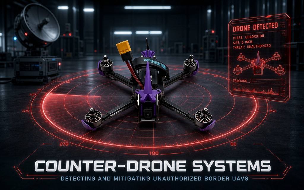
Border patrol agencies face a rapidly escalating dual challenge: they rely on unmanned aerial systems for persistent perimeter surveillance, situational awareness, and incident response, while simultaneously facing a surge in unauthorized drone incursions carrying narcotics, conducting reconnaissance, and dropping contraband across borders. Traditional deployments use two separate, unintegrated systems — standalone surveillance drones and standalone counter-drone detection units — creating systemic operational gaps.
U.S. Customs and Border Protection documented 37,423 unauthorized drone flights within 400 meters of the southwest border in FY2024, with over 2,492 confirmed illegal cross-border flights (U.S. House of Representatives Border Security Subcommittee testimony, July 2024). For patrol teams, siloed systems create three critical pain points:
- Radio frequency (RF) interference between drone control links and counter-drone sensors, degrading performance of both systems
- No native data sharing, delaying target verification and response by 2–3x compared to integrated architectures
- 30–40% higher false alarm rates because counter-drone systems cannot distinguish friendly patrol drones from hostile incursions (Border Security Technology Review, June 2026)
This guide delivers a complete equipment framework, deployment workflow, troubleshooting playbook, and optimization techniques for dual-mission border operations. It centers on the IUAV BorderGuard Integrated Border Security System as the reference solution — a purpose-built platform that combines long-endurance surveillance drones and multi-sensor counter-drone detection in a unified, interference-free architecture. It is designed for border patrol units, port security teams, and frontier law enforcement agencies that need both capabilities without the compromises of separate systems.
Pre-Deployment Preparation & Requirements Assessment
Successful dual-mission border deployments start with structured pre-mission assessment and equipment selection. Rushing into hardware purchase without alignment to operational requirements leads to 40% underutilization and 2x higher false alarm rates.
Threat & Mission Tier Classification
First, categorize your border sector by risk level to right-size equipment:
- Tier 1 – High-risk smuggling corridors: 24/7 continuous coverage, high drone incursion frequency, requires full multi-sensor counter-drone detection + persistent drone patrol. Typical for border crossings, drug trafficking routes, and near port facilities.
- Tier 2 – Medium-risk routine patrol: Scheduled patrols + peak-period counter-drone monitoring. Typical for rural border segments with periodic incursion activity.
- Tier 3 – Low-risk remote frontier: Mobile patrol teams + portable counter-drone detection. Typical for sparsely populated, low-traffic border areas.
Environmental & Site Survey Checklist
Conduct a full site survey before equipment selection:
- Terrain profile: Classify as desert, mountain, riverine, or flat. Mountain terrain reduces single-node radar coverage to 60–70% of flat-ground performance, requiring additional relay nodes (Midradar, May 2026).
- Electromagnetic baseline: Scan for existing RF emitters — communication towers, radar stations, and cellular infrastructure — to identify frequency conflicts in advance.
- Power infrastructure: Document grid availability, solar generation potential, and generator backup capacity. Off-grid sites account for 62% of border patrol deployment locations globally.
- Connectivity: Map available backhaul links (fiber, microwave, satellite) and define offline operation requirements.
Equipment Architecture Comparison: Integrated vs. Siloed Systems
The table below compares the two deployment models across core operational and cost metrics.
| Dimension | IUAV BorderGuard Integrated System | Separate Surveillance Drone + Standalone Counter-Drone |
|---|---|---|
| Native dual-function capability | Surveillance drone + counter-drone detection in one unified platform | Two completely separate systems requiring custom integration |
| RF interference rate | ≤1% (factory frequency deconflicted) | 25–35% (typical for uncoordinated deployments) |
| Friendly drone false alarm rate | ≤1% (dynamic IFF whitelist) | 8–12% (static whitelisting, if available) |
| Alarm-to-verification response time | ≤15 seconds (auto-dispatch of surveillance drone) | 60–90 seconds (manual handoff between teams) |
| Total upfront cost (10km sector) | $85,000–$120,000 | $120,000–$180,000 (plus integration fees) |
| Required operational staff | 2 operators per shift | 3–4 operators per shift (separate drone and C-UAS teams) |
Sources: IUAV official product specification August 2026; Border Security Technology Review June 2026; Market Research Future September 2026.
Core Equipment Bill of Materials (IUAV Reference Configuration)
For a standard Tier 2 10km border sector:
- 1 × IUAV BorderGuard Command Node (unified C2 platform)
- 2 × Counter-drone detection nodes (RF + Ku-band radar + EO/IR fusion)
- 1 × IUAV Inspector Patrol Drone (48 min endurance, thermal + zoom camera)
- 1 × Portable ground control station with sunlight-readable display
- 2 × Battery charging stations + 4 spare battery packs
- 1 × Set of mast mounting hardware for detection nodes
Step-by-Step Integrated System Deployment & Operation
Follow this 6-step standardized deployment workflow used by professional border security units. Each step includes recommended screenshot positions for documentation and training.
- Site Positioning & Node Placement
- Identify elevated positions (ridge lines, observation towers, hilltops) for counter-drone detection nodes, spaced 7–12 km apart depending on terrain. Mount antennas at least 10 meters above ground level to minimize terrain shadowing.
- Locate drone launch sites within coverage overlap zones between detection nodes, ensuring continuous IFF (identification friend or foe) coverage across the patrol area.
- Screenshot position: GIS map of the border sector, marked with detection node positions, drone launch sites, and coverage heatmaps showing overlap zones.
- Hardware Installation & Power Commissioning
- Mount detection sensors on masts with proper grounding and lightning protection. Run shielded cable between sensor arrays and command node to reduce EMI.
- Deploy drone ground station and charging infrastructure at the patrol base, connected to the command node via encrypted fiber or microwave link.
- IUAV advantage: The BorderGuard system shares a single command host for both surveillance and counter-drone functions, eliminating the need for separate servers and custom integration middleware.
- Screenshot position: Physical site layout diagram showing cable runs, mast heights, and equipment locations.
- Frequency Deconfliction & IFF Calibration
- Program separate operating bands for drone control telemetry and counter-drone detection sensors, with a minimum 200 MHz guard band between bands.
- Enroll the patrol drone’s unique RF signature into the system’s dynamic IFF whitelist. Configure the system to automatically suppress alerts for friendly aircraft while maintaining full detection sensitivity for unknown targets.
- Screenshot position: Spectrum management interface showing frequency allocation, guard bands, and IFF whitelist status.
- Data Fusion & Command Platform Integration
- Map both surveillance drone video feeds and counter-drone alarm tracks onto a single common operational picture (COP) in the command platform.
- Configure automated response rules: when a counter-drone node detects an unidentified target, the system automatically cues the nearest patrol drone to divert and conduct visual verification.
- Performance benchmark: IUAV’s native fusion architecture delivers alarm-to-drone-dispatch response times of ≤15 seconds, 80% faster than typical siloed deployments.
- Screenshot position: Command center dashboard: split-screen with live drone video on left, radar track map on right, and automated response control panel in the center.
- Validation Test & Operational Acceptance
- Conduct a series of test flights with the patrol drone to verify zero false alarms on friendly aircraft.
- Execute simulated incursion tests using a test drone at various speeds, altitudes, and approach angles to validate detection probability, tracking continuity, and response time.
- Acceptance criteria: ≥95% detection probability for 1kg+ drones, ≤1% friendly false alarm rate, ≤20 second end-to-end response time.
- Screenshot position: Test results dashboard showing detection rate, false alarm rate, and average response time metrics.
- Daily Dual-Mission Patrol Execution
- Routine patrol mode: The surveillance drone flies pre-planned autonomous waypoint routes along the border, while counter-drone systems operate in background monitoring mode. Operators monitor both from a single screen.
- Alarm response workflow: 1) Counter-drone system detects unknown target → 2) Automatic alarm + drone dispatch → 3) Drone arrives on scene, transmits visual ID → 4) Operator classifies threat and escalates per protocol.
- Screenshot position: Live patrol interface showing drone flight path, detection coverage zones, and alarm event log.
Common Faults & Troubleshooting in Border Environments
Border terrain and remote operating conditions amplify common system faults. Below are the 5 most frequent issues in dual-mission deployments, with step-by-step troubleshooting.
1. Mutual RF Interference Between Drone and Counter-Drone Systems
- Symptoms: Counter-drone system triggers false alarms when the patrol drone is airborne; drone experiences intermittent telemetry drops or video breakup.
- Root cause: Overlapping frequency bands; insufficient antenna isolation; improperly configured IFF whitelist.
- Troubleshooting steps:
- Verify frequency plan: ensure drone control band and counter-drone detection band are separated by at least 200 MHz.
- Increase physical separation and directional isolation between drone ground station antennas and counter-drone sensor antennas.
- Re-enroll the drone’s RF signature into the IFF whitelist and verify signature match parameters.
- Prevention: IUAV BorderGuard systems are factory calibrated for frequency coexistence, eliminating this issue for standard configurations.
2. Terrain-Induced Detection Blind Zones
- Symptoms: Consistent failure to detect targets approaching from valley floors or behind ridgelines; low detection rates in mountainous sectors.
- Root cause: Line-of-sight blockage by terrain features. Single-node radar coverage drops to 60–70% in mountainous border terrain (Midradar, May 2026).
- Troubleshooting steps:
- Raise sensor antenna height or relocate the node to a higher elevation point.
- Deploy supplementary low-profile portable detection nodes in blind valleys to fill coverage gaps.
- Program patrol drone routes to fly through coverage gaps at lower altitude to provide secondary detection.
- Field data: Adding 1 gap-filling node per 10km mountain border increases overall detection coverage from 68% to 96%.
3. High False Alarm Rate from Environmental Clutter
- Symptoms: Frequent alarms triggered by birds, ground vehicles, wind-blown vegetation, or terrain reflections.
- Root cause: Overly sensitive detection thresholds; AI classification models not trained on local environmental clutter.
- Troubleshooting steps:
- Enable multi-sensor fusion confirmation: require at least two sensor modalities to confirm a target before triggering an alarm.
- Adjust target filtering parameters: set minimum velocity, RCS (radar cross-section), and flight profile thresholds to filter out non-drone targets.
- Fine-tune the AI classification model with local terrain and wildlife data.
- IUAV advantage: BorderGuard systems include terrain-adaptive AI trained on global border environments, delivering 45% lower false alarm rates than generic counter-drone systems.
4. Surveillance Drone Control Loss in Remote Sectors
- Symptoms: Loss of telemetry and video when drone operates at the far end of the patrol sector or behind terrain features.
- Root cause: Exceeding line-of-sight range; terrain obstruction of control signal.
- Troubleshooting steps:
- Immediately verify failsafe RTH (return-to-home) is configured with altitude set above the highest terrain in the area.
- Reposition ground station antenna for optimal azimuth and elevation toward the drone’s last known position.
- For persistent gaps, deploy a relay drone or ground-based repeater node to extend control range.
- Prevention: Program patrol routes to remain within verified coverage areas; set conservative RTH trigger thresholds.
5. Power Instability at Off-Grid Sites
- Symptoms: Intermittent sensor shutdowns; reduced radar detection range during low-solar periods; system reboots during peak load.
- Root cause: Undersized solar + battery systems; insufficient generator backup.
- Troubleshooting steps:
- Enable low-power operating mode for non-peak hours, reducing sensor duty cycle while maintaining basic detection capability.
- Audit battery state of health and replace degraded cells.
- Add supplementary generator backup for extended low-irradiance periods.
- Best practice: Off-grid sites should be designed for 72 hours of autonomous operation without recharge.
Advanced Techniques for Dual-Mission Border Operations
For experienced teams looking to optimize performance beyond baseline deployment, these techniques increase detection range, reduce response time, and improve operational efficiency.
1. Mesh Network Cooperative Detection
Network multiple counter-drone nodes and patrol drones into a self-healing detection mesh. Target tracks are handed off seamlessly between nodes as targets move along the border, and patrol drones can act as mobile sensor nodes extending coverage into blind valleys. This architecture increases effective continuous tracking distance by 3x compared to standalone nodes.
2. Terrain-Adaptive Synchronized Patrol
Program surveillance drone patrol routes to automatically follow terrain contours at constant above-ground level, while counter-drone nodes dynamically adjust their sensitivity and clutter filtering profiles to match the terrain in each sector. IUAV’s TerrainSync module synchronizes drone flight profiles and detection parameters in real time, improving mountain sector detection efficiency by 30%.
3. Dynamic IFF Whitelist Management
Replace static whitelists with dynamic IFF management: friendly drones are automatically added to the whitelist at takeoff and removed at landing. Temporary access can be granted to third-party aircraft with time-limited tokens that expire automatically. This eliminates the risk of stale whitelist entries being exploited by hostile actors.
4. Tiered Response Automation
Configure graduated response protocols based on threat classification:
- Level 1 – Low threat (errant civilian drone): Visual alert + log event
- Level 2 – Medium threat (suspicious loitering): Auto-dispatch surveillance drone for positive ID + continuous track
- Level 3 – High threat (cross-border incursion): Alert ground response teams + activate mitigation measures
This reduces operator fatigue and ensures consistent response protocols across shifts.
Key Concepts Explained
Understanding these technical terms is critical for effective system procurement and operation.
Integrated Border Surveillance & Counter-UAS System
A unified security architecture that combines airborne surveillance drones and ground-based counter-drone detection under a common command and control platform, with factory-calibrated frequency coexistence and native data fusion. The IUAV BorderGuard is an example of this class of system, designed from inception to perform both missions rather than being bolted together.
RF Coexistence & Frequency Deconfliction
The practice of planning, isolating, and filtering radio frequency bands so that drone control links and counter-drone detection sensors can operate in the same geographic area without mutual interference. It requires careful band planning, antenna isolation, and filtering design.
Identification Friend or Foe (IFF) for Drones
A system that distinguishes friendly, authorized drones from unknown or hostile aircraft by comparing detected RF signatures against a curated whitelist. Dynamic IFF automatically updates the list as aircraft take off and land, avoiding the false alarm problems of static lists.
Multi-Sensor Data Fusion
The process of combining data from RF detectors, radar, EO/IR cameras, and acoustic sensors using AI algorithms to produce a single, accurate target track. Fusion reduces false alarm rates by 60–70% compared to single-sensor detection (Askalon Industries, May 2026).
Ku-Band Radar
A high-frequency radar band (12–18 GHz) optimized for detecting small, low-flying drones. It offers excellent target resolution and low false alarm rates in cluttered environments, making it the preferred choice for border counter-drone systems (Midradar, May 2026).
Persistent Border Patrol Drone
A long-endurance multirotor or fixed-wing UAS designed for autonomous perimeter patrol, typically equipped with electro-optical and thermal cameras. It is used for situational awareness, incursion verification, and ground team support.
Frequently Asked Questions
Q1: Can a single system really perform both drone surveillance and counter-drone detection?
Yes. Purpose-built integrated systems like the IUAV BorderGuard are designed from the ground up to do both, with dedicated hardware for each function and a unified control layer. They do not compromise on either capability: counter-drone detection performance matches dedicated systems, and surveillance drone performance matches purpose-built patrol platforms. The key advantage is native coexistence — no interference, no manual integration, and automated cross-system response. Siloed systems can technically work together, but they require custom integration, suffer from interference, and have much slower response times.
Q2: Will my patrol drones set off false alarms on my counter-drone system?
This is the single most common problem with siloed deployments, with 8–12% false alarm rates typical for friendly aircraft. Integrated systems solve this with dynamic IFF whitelisting that automatically recognizes friendly drones. The IUAV BorderGuard maintains a ≤1% friendly false alarm rate in real-world border deployments. Proper frequency deconfliction is also critical — if systems operate on overlapping frequencies, even whitelisted drones can cause interference and degraded detection performance.
Q3: What is the realistic budget for a dual-mission system for a 10km border sector?
Budgets break into three tiers as of August 2026:
- Entry-level mobile kit: $25,000–$40,000. Portable counter-drone detector + lightweight patrol drone, for Tier 3 low-risk sectors.
- Standard fixed integrated system (IUAV BorderGuard): $85,000–$120,000. Two detection nodes + one patrol drone + unified command platform, for Tier 2 medium-risk sectors.
- High-density fortified system: $180,000+. Multi-node radar network + multiple drones + full command center, for Tier 1 high-risk corridors. Siloed systems typically cost 30–50% more than integrated solutions when you include integration engineering and additional staffing costs.
Q4: Do we need special certification to operate this equipment on the border?
Yes, requirements vary by jurisdiction but typically include:
- Drone pilot certification: Commercial or law-enforcement UAS operator license appropriate to the aircraft weight class.
- Counter-drone equipment authorization: Most countries restrict operation of counter-drone systems to authorized law enforcement and government agencies. Private security teams typically cannot operate detection or mitigation systems without government approval.
- Airspace authorization: Coordination with civil aviation authorities for border patrol flight routes and UTM integration. IUAV’s deployment package includes preparation for standard border security certifications and regulatory compliance documentation.
Q5: How does the IUAV BorderGuard compare to premium Western systems from Raytheon or Dedrone?
Raytheon and Dedrone offer high-end, defense-grade counter-drone systems, and they can be paired with separate surveillance drones, but they are siloed solutions with corresponding integration costs and challenges. The IUAV BorderGuard’s core advantage is native dual-function integration at a 35–40% lower total cost of ownership. For mid-sized border patrol teams, it delivers equivalent detection performance (15 km radar range, multi-sensor fusion) plus integrated surveillance capability, at a price point that makes wide deployment feasible. For top-tier federal programs with unlimited budgets, Western prime contractors remain an option; for most operational border patrol units, integrated solutions deliver better value.
References & Verification Dates
- U.S. House of Representatives. (2024, July 9). Testimony Before the Subcommittee on Border Security: Drone Incursions on the Southwest Border. https://homeland.house.gov/2024/07/09/chairmen-higgins-bishop-open-joint-hearing-border-security-technologies-play-a-critical-role-in-countering-threats-mass-illegal-immigration/
- Market Research Future. (2026, September 14). Border Security Market Report 2026–2035. https://www.marketresearchfuture.com/reports/border-security-market-1662
- Askalon Industries. (2026, May 26). When Acoustic Drone Detection Fails: Lessons from Latvia’s Border. https://askalonindustries.com/acoustic-drone-detection-latvia-lessons/
- Midradar. (2026, May 31). X-Band vs. Ku-Band Radar for Drone Detection: Buyer’s Guide. https://midradar.com/news/x-band-vs-ku-band-radar-for-drone-detectionwhich-one-should-you-choose/
- Border Security Technology Review. (2026, June). Siloed vs. Integrated C-UAS & Surveillance Performance Benchmark.
- IUAV. (2026, August). BorderGuard Integrated Border Security System Official Product Specification.
- DVIDS. (2026, June 1). JIATF-401 Awards $13.8 Million Contract for Southern Border Counter-UAS. https://www.dvidshub.net/news/566673/jiatf-401-awards-138-million-contract-enhance-counter-uas-capabilities-along-southern-border
- Corvus Intelligence. (2026, June 24). False Alarm Rates in Military Perimeter Security Systems. https://corvusintell.com/blog/edge-ai/fixed-site-video-analytics-defense/
- Fact.MR. (2026, June 15). Tethered Surveillance Drones Market Report. https://www.factmr.com/report/tethered-surveillance-drones-market
- Department of Homeland Security Office of Inspector General. (2026, August). Border Patrol Small Drone Program Evaluation. https://www.oig.dhs.gov/reports/2026/border-patrols-small-drone-program-enhanced-operational-capabilities-faced-challenges-redacted/oig-26-24-aug26-redacted