
In Stock — Ready to Ship
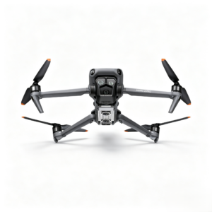
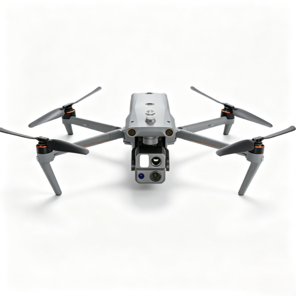
Autel EVO Max 4T XE Camera Drones
Autel EVO Max 4T XE thermal drone with 4K camera, 10x optical zoom, 640×512 thermal imaging, RTK support and 15km transmission for industrial UAV missions.
★ Pilot RewardsEarn Pilot Points with this purchase
Fast, Tracked ShippingOrders ship from our U.S. warehouse with tracking. Delivery estimates appear during checkout.
Autel EVO Max 4T XE Industrial Flagship Drone | 4K 10x Zoom Thermal Imaging UAV for Inspection & Public Safety
Product Overview
The Autel EVO Max 4T XE, developed by Autel Robotics, is a flagship industrial-grade multirotor drone purpose-built for public safety, energy inspection, emergency management, geographic surveying and other professional field operations.
Powered by Autel Autonomy autonomous flight technology, industry-first A-Mesh ad hoc networking, dual fisheye vision + millimeter-wave radar multi-sensor fusion perception, and the integrated Rongguang 4T XE 4-in-1 gimbal system, this UAV delivers fully autonomous operation, multi-drone team collaboration and all-domain all-day perception in harsh, signal-compromised environments, setting a new performance benchmark for industrial drone applications.
With a foldable airframe for maximum portability and full expandability with professional payloads such as an RTK centimeter-level positioning module and loudspeaker-searchlight combo unit, the EVO Max 4T XE is fully adaptable to power line inspection, law enforcement, firefighting rescue, emergency search and other mission-critical scenarios, delivering an efficient, reliable and safe aerial operation solution for enterprise and government users.
Core Performance Advantages
1. Full-Environment Autonomous Flight & High-Precision Navigation
Autel Autonomy Autonomous Flight Technology
Equipped with a high-computing on-board chip and proprietary autonomous flight algorithm, the drone captures real-time 3D environmental data and automatically executes global path planning, 3D scene reconstruction, dynamic obstacle avoidance and smart return-to-home (RTH) in complex terrains including mountainous terrain, dense woodlands and urban canyons. It runs standardized inspection and survey missions without delicate manual control, drastically reducing operator workload, lowering training thresholds and improving mission consistency and efficiency.
High-Precision SLAM Visual Navigation
For scenarios with blocked satellite signals, weak GNSS or strong electromagnetic interference, the onboard SLAM visual navigation system outputs high-precision, low-latency distance and coordinate data, enabling seamless indoor-outdoor navigation and stable hovering even when satellite connectivity is lost. This capability breaks the traditional reliance of industrial drones on continuous satellite signals.
Multi-Constellation GNSS & Robust Anti-Interference System
It supports GPS + GLONASS + Galileo + BDS four-satellite constellation positioning, paired with Autel SkyLink 3.0 multi-band adaptive frequency hopping transmission to maintain stable control links and HD video feed even in electromagnetically complex environments. Maximum video transmission range reaches 15 km under FCC standards, supporting large-scale outdoor operations.
2. 720° Omnidirectional Multi-Sensor Fusion Obstacle Avoidance
Featuring a dual-system architecture of dual fisheye vision perception + millimeter-wave radar, the EVO Max 4T XE delivers 720° full-environment perception covering front, rear, top, bottom, left and right directions, enabling reliable all-day operation in variable weather and lighting conditions.
- Vision Perception System: Dual pinhole lenses (front/rear) and dual fisheye lenses (top/bottom) provide full spherical visual coverage, identifying textured obstacles and working with on-board AI to execute path planning and dynamic collision avoidance.
- Millimeter-Wave Radar Perception: 60GHz millimeter-wave radars (front/rear/up directions) penetrate haze, smoke and low light to reliably detect glass, thin power lines, water surfaces and other obstacles that challenge vision-only systems. The downward-facing radar assists precision landing and low-altitude obstacle detection.
- Intelligent Avoidance Modes: Two selectable avoidance behaviors — Brake and Bypass — with customizable safety distance and warning distance thresholds. The system autonomously plans optimal detour paths, minimizing crash risk in low-altitude and cluttered operation environments.
Note: Millimeter-wave radar configurations vary by region to comply with local regulatory requirements; specifications are subject to the actual shipped version.
3. Industry-First A-Mesh Ad Hoc Networking
Breaking the limits of single-drone operations, A-Mesh technology enables free device-to-device networking between drones and ground terminals, establishing a local air-ground communication network for coordinated multi-drone missions.
- Multi-Mode Team Operation: Supports “one controller to multiple drones” and “master-slave dual control” collaboration modes. Multiple units can join a single team for task division, live feed sharing and real-time data synchronization.
- Off-Grid Operation: Works in remote areas with no cellular coverage — such as mountain valleys, tunnel environments and enclosed structures — to maintain inter-device connectivity, ideal for emergency rescue and covert operation scenarios.
- Relay-Extended Range: Supports long-distance and obstacle-crossing transmission via drone-to-drone relay, extending effective operation radius and signal coverage far beyond the limits of a single aircraft.
4. Rongguang 4T XE 4-in-1 Professional Gimbal System
The integrated gimbal combines a 10x optical zoom camera, ultra-sensitive wide-angle camera, infrared thermal imager and laser rangefinder into one compact unit, covering long-range observation, wide-area situational awareness, thermal temperature detection and precision ranging in a single payload.
10x Continuous Optical Zoom Camera
1/2-inch CMOS sensor with 48MP effective pixels, 10x continuous optical zoom and 160x digital zoom, with adjustable F2.8–F4.8 aperture. Captures up to 8000×6000 stills and 4K@30fps video. Capable of clearly identifying vehicle, vessel and equipment details from up to 2 km away for long-range inspection and surveillance.
Ultra-Sensitive Wide-Angle Camera
1/2-inch CMOS sensor with 48MP effective pixels, 83.4° field of view, 24mm equivalent focal length, and up to ISO 320000 ultra-low-light performance. Delivers bright, clear wide-area imagery even in dim environments, suitable for site overview, low-altitude mapping and night scene documentation.
Infrared Thermal Imaging Camera
640×512 resolution, 9.1mm focal length, 16x digital zoom, with dual temperature measurement ranges: -20℃ to +150℃ (high gain) / 0℃ to +550℃ (low gain). Temperature accuracy reaches ±2℃ or ±2% of reading (whichever is greater). Supports center-point, spot and area temperature measurement with customizable high/low temperature alarms. Penetrates darkness and smoke to locate heat sources and human targets for firefighting, power equipment thermography and search & rescue.
Laser Rangefinder
Measurement range 5–1200 meters, with accuracy of ±(1 m + D×0.15%) (D = measured distance). Delivers precise distance, altitude and geodetic coordinates of targets, supporting inspection marking, survey control points and geotagged evidence collection.
5. High-Efficiency Field-Ready Design
- 42-Minute Max Flight Time: 42-minute endurance in windless laboratory conditions, with an optimized powertrain to reduce battery swap frequency and maximize per-mission coverage.
- Hot-Swappable Battery: Supports battery replacement without powering down the aircraft. Swap can be completed within 8 seconds, eliminating reboot and self-check downtime for uninterrupted long-duration operations.
- Durable Airframe: Customizable IP43 ingress protection for dusty and light-rain environments. Foldable arms enable compact storage for single-person carry and rapid field deployment.
- Multi-Band Secure Transmission: Autel SkyLink 3.0 transmission with 900MHz / 2.4GHz / 5.8GHz adaptive frequency hopping for strong anti-interference performance, stable low-latency video feed, and AES-256 end-to-end data encryption.
Key Technical Specifications
| Category | Parameter | Specification |
|---|---|---|
| Airframe | Takeoff Weight | 1635 g (battery, gimbal, propellers included) |
| Maximum Takeoff Weight | 1999 g | |
| Folded Dimensions | 257×145×131 mm (without propellers) | |
| Ingress Protection | IP43 (custom order) | |
| Flight Performance | Max Flight Time | 42 min (windless lab conditions) |
| Max Horizontal Speed | 23 m/s (Sport mode) | |
| Max Wind Resistance | 12 m/s | |
| Operating Temperature | -20℃ ~ +50℃ | |
| Max Service Ceiling | 4000 m (with ABX40 battery) | |
| Perception System | Sensing Architecture | Dual fisheye vision + millimeter-wave radar fusion |
| Coverage | 720° omnidirectional | |
| Avoidance Modes | Brake / Bypass / Off | |
| Gimbal & Cameras | Zoom Camera | 1/2″ CMOS, 48MP, 10x optical zoom, 8K photo / 4K video |
| Wide-Angle Camera | 1/2″ CMOS, 48MP, 83.4° FOV, ultra-sensitivity mode | |
| Thermal Camera | 640×512, -20℃~550℃ dual-range thermography | |
| Laser Rangefinder | 5–1200 m range, ±(1m+D×0.15%) accuracy | |
| Transmission | Max Range | 15 km (FCC, unobstructed line-of-sight) |
| Frequency Bands | 900MHz / 2.4GHz / 5.8GHz adaptive hopping | |
| Encryption | AES-256 end-to-end | |
| Power System | Standard Battery | ABX40 smart battery |
| Capacity | 8070mAh / 120Wh | |
| Charge Time | ~90 min (up to 247W charging) | |
| Hot-Swap | Supported, 8-second swap |
Core Industrial Applications
Power Line & Utility Inspection
The zoom camera inspects tower hardware, insulators and conductor condition in fine detail; thermal imaging detects hotspots, discharge faults and abnormal heating; the laser rangefinder measures conductor clearance and tower dimensions. Autonomous waypoint missions enable routine grid inspection with greater efficiency and safety than manual climbing patrols.
Emergency Search & Rescue
In mountain, maritime and disaster environments, thermal imaging locates survivors in darkness and through smoke. A-Mesh networking enables multi-drone coordinated search to expand coverage area. When paired with the loudspeaker-searchlight payload, it supports remote voice guidance and night illumination to improve rescue success rates.
Law Enforcement & Public Security
Supports wide-area perimeter patrols and real-time aerial overwatch of incidents. The long zoom camera captures evidentiary detail at standoff distances, while thermal imaging enables covert night surveillance. A-Mesh networking builds an on-site air-ground command network, delivering geotagged live data to incident commanders for faster, more informed response.
Geographic Surveying & Mapping
Supports waypoint missions and polygon grid mapping missions. With the optional RTK module, it achieves centimeter-level positioning accuracy, producing high-resolution orthophotos and 3D reconstruction source data for land survey, topographic mapping and construction progress monitoring.
Firefighting & Rescue Operations
Provides aerial situational awareness of fire spread and structural conditions. Thermal imaging penetrates heavy smoke to pinpoint fire origins and trapped personnel, delivering real-time temperature data to command teams. An optional loudspeaker payload supports public address and evacuation instructions.
Optional Industrial Accessories
-
RTK Module (XRT-2301X)
Enhances electromagnetic interference resistance and delivers centimeter-level positioning accuracy for high-precision inspection and survey-grade mapping missions.
-
Loudspeaker & Searchlight Combo Unit (DU4)
Quick-mount screw-on design. The searchlight supports remote tilt control or gimbal-synchronized auto-tracking, with 30Lux@50m / 3Lux@150m illumination. The loudspeaker reaches 300 meters with 114dB@1m output for emergency command and night operations.
Product Summary
The Autel EVO Max 4T XE stands as a flagship industrial drone solution defined by four core strengths: autonomous flight capability, omnidirectional collision safety, multi-drone mesh networking, and an all-in-one multi-sensor gimbal. Balancing portability, ruggedness and expandability, it is engineered to serve energy, public safety, emergency response and surveying industries, delivering a reliable aerial productivity tool that reduces operational costs and elevates mission performance.
| SKU | IUAV-14117 |
|---|
You May Also Like
Drone, FPV Freestyle Drones, Strike Recon Drones
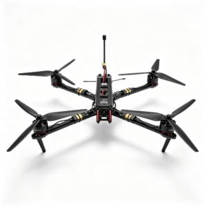
10‑inch FPV Heavy‑lift Drone | Max 5KG Payload FPV Quadcopter
View Options
Drone, FPV Freestyle Drones, Strike Recon Drones